Hiking in Portugal: Trails and How to Prepare
Disclosure: This article contains affiliate links. If you buy through them, we may earn a commission at no extra cost to you. Read our full disclosure.
Moving to or visiting Portugal often inspires a grand vision of sunny coastal strolls and majestic mountain vistas. However, many hikers quickly discover that navigating rural trailheads, unexpected weather microclimates, and cryptic trail markings can turn a pleasant day walk into a confusing ordeal. This comprehensive guide covers Portugal’s most iconic hiking regions, practical preparation strategies, safety protocols, and local transport realities to ensure your trekking adventures are smooth, safe, and deeply rewarding.
Coastal Trails and Fisherman Paths
Portugal’s coastline offers some of the most spectacular marine hiking in Southern Europe. The combination of dramatic ocean cliffs, hidden sea caves, and golden sand dunes makes coastal walking a favorite activity for both short-term visitors and long-term residents. However, walking along exposed cliffs requires a keen understanding of local terrain, tide movements, and exposure to wind and sun.
The Rota Vicentina and Trilho dos Pescadores
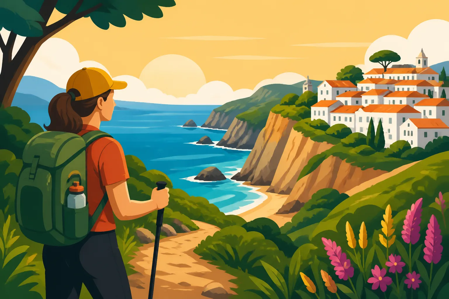
Spanning the southwestern coast through the Alentejo and Algarve regions, the Rota Vicentina is a vast network of historical trails and coastal tracks. Its most famous section, the Trilho dos Pescadores (Fishermen’s Trail), clings closely to the ocean, winding along sandy paths used for generations by locals accessing remote fishing spots. Walking this path means feeling the spray of the Atlantic, witnessing white storks nesting on sheer sea stacks, and treading through fragrantly scented scrubland filled with wild rosemary and rockrose.
Trekking the Fishermen’s Trail is physically demanding in a unique way. Rather than steep vertical ascents, the primary challenge is deep, soft sand that taxes your calves and ankles over long distances. Exposure is constant; there is virtually no tree canopy to shade you from the midday sun. Hikers transitioning between rural coastal villages like Porto Covo, Vila Nova de Milfontes, and Zambujeira do Mar often arrange multi-day stays using platforms like Booking.com to secure traditional guesthouses along the route. Planning your daily mileage conservatively is essential because walking five kilometers through soft dune sand takes significantly more time and energy than walking the same distance on hard-packed soil.
Seven Hanging Valleys Trail in the Algarve
Situated in the central Algarve near Lagoa, the Seven Hanging Valleys Trail (Percurso dos Sete Vales Suspensos) is regularly celebrated as one of Europe’s premier day hikes. Stretching roughly six kilometers one way between Praia da Marinha and Praia do Vale de Centeanes, the path threads past carved limestone cliffs, natural arches, and towering sinkholes (algares) through which the sea roars below.
While short enough for a relaxed half-day outing, the trail demands proper footwear and constant vigilance. The limestone surface is uneven, sharp, and occasionally slick from sea spray or loose gravel. Fences line vulnerable cliff edges, but many sections remain natural and unbarricaded. It is crucial to stay on the marked paths and resist the urge to step beyond safety barriers for photographs, as cliff erosion is a constant, unpredictable hazard. If you prefer structured excursions with local naturalists who explain the coastal geology, booking a group trekking option via GetYourGuide offers a safe, educational alternative to self-guided walking.
Logistics Accommodation and Coastal Navigation
Planning a multi-day coastal trek requires careful preparation regarding lodging, luggage transfer, and seasonal timing. Summer temperatures along the Southern coast can easily make cliffside walking dangerous due to heat exhaustion and dehydration. The ideal window for coastal hiking spans from October through May, when temperatures are mild, spring wildflowers bloom across the cliffs, and accommodation prices drop significantly compared to peak summer resort rates.
Logistically, coastal trails often start and end in small villages with limited public bus schedules. If you are not renting a vehicle, mapping out regional regional bus connections or booking long-distance coaches through platforms like Omio can help you connect major transit hubs like Lisbon or Faro to coastal trailheads. Additionally, water sources along coastal paths are practically non-existent between towns. You must carry sufficient hydration for the entire leg of your journey, as coastal winds can mask how much sweat you are losing, leading to rapid dehydration.
Mountain Ranges and Inland Wilderness
Beyond its world-class coastline, inland Portugal harbors rugged mountain ranges, deep river canyons, and ancient granite villages. Moving away from the coast reveals a wilder, quieter side of the country where traditional pastoral life continues much as it has for centuries.
Serra da Estrela and Glacial Valley Routes
As mainland Portugal’s highest mountain range, the Serra da Estrela provides high-altitude terrain, alpine plateau landscapes, and dramatic glacial valleys. The Zêzere Glacial Valley, stretching down toward the mountain town of Manteigas, is the crown jewel of the region. Hiking here takes you past towering granite walls, mountain streams, and terraces where shepherd huts dot the hillside.
Hiking in the Serra da Estrela is vastly different from coastal walking. High-altitude weather changes rapidly, bringing thick fog, sudden temperature drops, and torrential rain even during late spring or early autumn. Winter brings snow and ice to the upper peaks near the Torre, requiring full winter gear and navigation skills. When settling into mountain towns like Manteigas or Covilhã, preparing for atmospheric shifts is paramount. It pays to consult local mountain weather forecasts daily and consult a Living in Portugal Guide 2027: The Complete Relocation Manual for Expats to better understand how regional climate patterns vary between coastal zones and the interior highlands.
Peneda Gerês National Park Exploration
Located in the far northwest corner along the Spanish border, Peneda-Gerês is Portugal’s only designated National Park. It is a world of lush oak forests, deep granite gorges, natural swimming pools, and ancient stone villages like Lindoso and Soajo, famous for their traditional grain stores (espigueiros). The park is home to rich biodiversity, including wild Garrano horses, roe deer, and even Iberian wolves.
Navigating Gerês requires careful planning because the terrain is vast and mobile phone service is frequently lost in deep valleys. Trail networks range from short, paved cultural walks to long, demanding mountain traverses. Certain areas of the park are strictly protected nature reserves where human access is limited or requires special permits from the park authority (ICNF). When planning a trip to Gerês, ensure you download offline mapping layers before setting off and consider hiring a licensed local guide if you intend to venture into the park’s remote core zones.
Passadiços do Paiva and Walkway Hiking
In recent years, Portugal has pioneered the development of passadiços—elevated wooden boardwalks built along scenic river canyons and nature reserves. The most famous of these is the Passadiços do Paiva, located in Arouca. Stretching over eight kilometers along the left bank of the Paiva River, this network of wooden walkways and staircases provides access to breathtaking river rapids, waterfalls, and steep gorge walls that were previously accessible only to experienced kayakers or mountain climbers.
While wooden walkways eliminate the technical challenge of navigating rocky ground, they introduce physical challenges of their own, notably thousands of wooden steps that test leg endurance. The walkways get exceptionally hot on sunny days, as the wood radiates heat and canyon walls block breeze circulation. Because access to the Passadiços do Paiva is controlled to preserve the environment, visitors must purchase access tickets online in advance. Pairing this walk with a crossing of the nearby 516 Arouca suspension bridge creates a full-day adventure, though it is not recommended for those who suffer from severe vertigo.
| Region | Primary Trail Type | Technical Difficulty | Best Season | Key Highlights |
|---|---|---|---|---|
| Algarve Coast | Limestone cliffs, beach paths | Moderate | October to April | Sea caves, natural arches, sinkholes |
| Vicentine Coast | Sand dunes, cliff tracks | Moderate to High | October to May | Wild sea stacks, stork nests, coastal scrub |
| Serra da Estrela | Alpine granite, glacial valleys | High | May to October | Glacial canyons, high peaks, mountain lakes |
| Peneda-Gerês | Granite trails, mountain passes | High | April to June, Sept to Nov | Ancient villages, waterfalls, wild horses |
| Arouca / Paiva | Elevated wooden boardwalks | Low to Moderate | March to June, Sept to Nov | River gorges, suspension bridge, rapids |
| Madeira Island | Irrigation channels (levadas) | Moderate | Year-round | Laurissilva forest, mountain ridges, waterfalls |
Island Trekking in Madeira and the Azores
Portugal’s Atlantic archipelagos offer tropical flora, volcanic landscapes, and world-class trekking routes that feel entirely distinct from the mainland. Both Madeira and the Azores are bucket-list destinations for serious hikers, but their island environments introduce unique safety considerations.
Madeira Levada Walks and Mountain Peaks
Madeira’s defining hiking feature is its system of levadas—man-made irrigation channels built over centuries to carry water from the wet north side of the island to the dryer agricultural south. Walking alongside these channels provides relatively flat, easy-to-follow routes into deep, sub-tropical UNESCO-protected Laurissilva forests, past roaring waterfalls, and through carved rock tunnels. Popular routes include Levada do Caldeirão Verde and Levada das 25 Fontes.
For those seeking high-altitude thrill, Madeira’s central mountain massif features dramatic ridge-line treks, such as the famous trail connecting Pico do Arieiro to Pico Ruivo. This route winds along high crests above the clouds, passing through rock tunnels and up sheer staircases built into mountain spines. Because trails along levadas often run beside steep drop-offs with narrow ledges, anyone prone to acrophobia should research specific routes thoroughly. Wearing a quality headlamp is required for long tunnel sections, and water-resistant gear is essential, as water continuously drips from tunnel ceilings.
Volcanic Crater Trails in the Azores
The nine islands of the Azores feature volcanic landscapes dominated by massive calderas, geothermal fumaroles, crater lakes, and vibrant green pastures. On São Miguel Island, walks around Sete Cidades and Lagoa do Fogo showcase stunning dual-colored lakes sitting inside dormant volcanic craters. On Pico Island, ascending Mount Pico—Portugal’s highest peak at 2,351 meters—presents a rigorous volcanic climb over loose lava rock and steep scrambles.
Hiking in the Azores requires adapting to rapid, hyper-local weather shifts. You can easily experience sunshine, thick fog, wind, and rain within a single hour. The terrain is frequently muddy, slippery, and overgrown with native vegetation. Sturdy, waterproof hiking boots with aggressive tread are absolute necessities. When ascending Mount Pico, registration at the mountain guide house is mandatory, and climbers are issued GPS tracking devices so rangers can monitor their progress and respond in case of sudden weather collapse.
Weather Volatility and Island Safety Precautions
The overriding rule for island trekking in both Madeira and the Azores is respect for sudden atmospheric changes. Mountain peaks on both archipelagos regularly generate their own weather systems, independent of what is happening at sea level. A warm, sunny morning in Funchal or Ponta Delgada can turn into a cold, blinding fog with heavy downpours at higher elevations by mid-day.
Before heading into the mountains, always check local webcam networks (such as SpotAzores or Madeira webcams) to verify real-time conditions at the trailheads. Never venture onto exposed ridges or high mountain passes if dense fog or gale-force winds are predicted. If caught in a sudden storm, stay on the marked path; stepping off trails on steep volcanic islands can lead to hidden sheer drops concealed by thick ferns or vegetation.
Trail Markings Maps and Local Navigation Realities
Understanding how trails are classified, marked, and maintained in Portugal will save you from getting lost in remote areas where signs may be missing or damaged by weather.
Deciphering the Portuguese Marking System
Portugal utilizes a standardized color-coded trail marking system maintained by the Portuguese Camping and Mountaineering Federation (FCMP) alongside local municipalities. You will see these marks painted on rocks, trees, wooden posts, and walls throughout the countryside:
- GR (Grande Rota / Long Distance Route): Marked with red and white parallel stripes. These multi-day trails cover long distances, such as the GR11 or major Caminho de Santiago routes.
- PR (Pequena Rota / Short Route): Marked with red and yellow parallel stripes. These are circular or linear day hikes, typically under 30 kilometers in length.
- PL (Percurso Local / Local Route): Marked with green and white stripes. These are short thematic routes, often focused on local history, flora, or urban heritage.
Along the trail, painted symbols guide your movement. Two parallel horizontal bars indicate you are on the correct path. An “X” shape made of two crossing colored bars indicates a wrong turn. A right-angle turn symbol shows where the path changes direction sharply. Learning to read these simple painted markers is essential, particularly at ambiguous intersections in rural farmland.
Digital Tools vs Offline Maps in Remote Areas
While physical painted markers are common on major routes, maintenance can be inconsistent in remote regions. Vegetation can grow over painted rocks, or old wooden posts might be knocked down during winter storms. Relying solely on visual markers or mobile network connectivity is a common mistake made by inexperienced hikers.
Before setting out, download detailed offline maps using specialized applications such as AllTrails, Wikiloc, or Komoot. Wikiloc is exceptionally popular in Portugal, meaning locals frequently upload accurate, updated GPS tracks of obscure rural routes. Ensure your phone is fully charged and consider carrying a compact portable power bank. In deep river canyons or thick mountain pine forests, GPS signals may occasionally drift, so having a basic physical map and compass in your pack provides invaluable backup redundancy.
Transport and Getting to Remote Trailheads
Reaching rural trailheads in Portugal can present a logistical puzzle if you rely strictly on public transit. While major towns are connected by national rail networks operated by Comboios de Portugal, small villages near national parks or coastal start points often have minimal bus service, especially on weekends and public holidays.
To navigate these transit gaps, plan your connections well in advance. Check regional bus schedules online or utilize multimodal transit search engines like Omio to coordinate trains and long-distance buses. For remote regions like Gerês or the inner Alentejo, renting a vehicle offers maximum flexibility. If you are doing a linear point-to-point hike, arrange local taxi transfers or ride-share pickups at your endpoint beforehand, as hailing a ride spontaneously in a village of fifty people is often impossible. For details on handling regional travel logistics, consult our overview on Public Transport and Driving in Portugal: Trains, Tolls, and Licenses.
Essential Preparation Gear and Seasonal Planning
Proper preparation transforms a challenging hike into an enjoyable adventure. Matching your gear and supplies to Portugal’s specific climate and terrain ensures safety across all seasons.
Beating the Summer Heat and Managing Water Resources
Summer hiking across mainland Portugal presents serious risks of heatstroke and severe sunburn. Between June and September, inland temperatures frequently surpass 35 degrees Celsius (95 degrees Fahrenheit). Hiking during the middle of the day in regions like Alentejo, Douro Valley, or the interior Algarve is strongly discouraged.
If you hike in summer, start at dawn and aim to finish your trek before noon. Wear wide-brimmed hats, UV-blocking sunglasses, and high-SPF sunscreen. Carry a minimum of two to three liters of water per person. Do not rely on finding potable water sources along rural paths. While village fountains (fontes) are common, many are marked with signs reading “Água Não Potável” (Non-Potable Water). Drinking untreated water from streams near livestock pastures carries a high risk of stomach illness; learn more about local water standards in our guide on Water safety and stomach bugs: Do expats get sick from Portuguese tap water?.
Footwear Clothing Layers and Mold Humidity Considerations
Selecting appropriate footwear depends entirely on the terrain. For sandy coastal paths like the Fishermen’s Trail, breathable, light hiking shoes or trail runners fitted with gaiters help keep abrasive sand out of your socks. For granite scrambles in Gerês or volcanic rock in Pico, sturdy, high-cut boots with strong ankle support and thick soles are essential to protect against sharp edges and rolling stones.
Layering is vital due to changing microclimates. In maritime and mountain environments, conditions shift quickly. A lightweight windbreaker and waterproof shell should always sit in your daypack, even if the morning sky is clear. In coastal or forest environments, high humidity can cause sweat to condense inside non-breathable jackets, making you cold once you stop moving. Merino wool or synthetic moisture-wicking base layers outperform cotton in keeping you dry and comfortable.
Emergency Contacts Wildlife and Safety Protocols
Portugal is generally a very safe country for outdoor recreation. Dangerous wildlife is rare; Iberian wolves in the north avoid humans, and the few venomous snake species (such as the Lataste’s viper) are shy and seldom encountered. However, insects like ticks are common in high grass during spring, and pine processionary caterpillars—whose microscopic hairs cause severe allergic reactions in humans and pets—are prevalent in pine forests from late winter through early spring. If you suffer from seasonal allergies or insect sensitivity, review our resource on Allergy season in Portugal: Pine pollen and over-the-counter antihistamines.
Always carry a compact medical kit tailored for outdoor excursions. Check our advice on What to pack in a first-aid kit when moving to a rural Portuguese village to assemble essential supplies like blister pads, antiseptic wipes, elastic bandages, and tweezers.
In an emergency, the European universal emergency number is 112. Portuguese dispatchers generally speak English, particularly in tourist and coastal zones, but knowing basic Portuguese phrases can help speed up response times in rural inland areas. For full details on contacting emergency services, refer to Calling 112: Do Portuguese emergency dispatchers speak fluent English?. Furthermore, understanding how healthcare access functions for residents and tourists alike is detailed in our comprehensive guide on Healthcare in Portugal for Expats: The Complete 2026 Medical Guide.
Always share your planned route and estimated return time with a friend or family member before setting off into remote areas. If you are hiking solo, use live location-sharing features on your smartphone or carry a satellite messenger device if venturing far off the grid.
Disclaimer
This article is for general informational purposes only and does not constitute professional advice. Laws, prices and regulations vary by location and change over time. Consult a qualified professional for guidance on your specific situation.